Synopsis
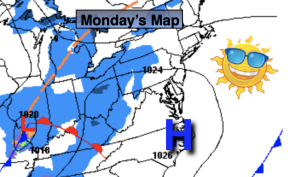
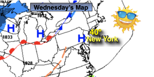
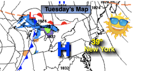
High pressure off the Eastern seaboard will dominate our area today. A Southwest flow will result in a continued warming trend. Our trend of above average temperatures will continue (average temps are around 40º for highs) and readings will be at least ten degrees higher than normal for the rest of the five day period. Enjoy the break from the cold while it lasts!
The next chance of showers will come Saturday, New Year’s Eve. Low pressure will move out of the Southern Appalachians. Showers should develop by afternoon. It’s a mild storm track, equating to no snow. At the stroke of midnight rain is expected and it’ll be very mild with readings around 50º!
The storm will move out of the region for New Year’s Day but the mild temperatures will stick around for the beginning of 2023 as all the cold air is locked up in Canada. It’ll be a mainly sunny through the first few days in January. Not feeling like the season whatsoever.
Stay tuned.
Keep it here for a no hype, no nonsense forecast.
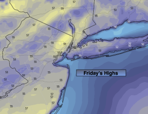
Friday:
Mostly sunny. Mild. Highs in the mid 50s. Southwest winds at 5-10mph.
Tonight:
Becoming mostly cloudy late. Milder than the average high for the date! Lows in the upper 40s along the urban corridor to the upper 30s and 40s inland. Light Southwest winds.
New Year’s Eve:
Mostly cloudy. Mild. Chance of afternoon rain. Highs in the mid 50s..
New Year’s Day:
Mostly sunny. Still mild. Highs in the lower to mid 50s.
Monday:
Sunny. Highs around 50º.
Tuesday:
Sunny. Highs in the mid 50s.