Synopsis:
A storm will be over Eastern New England today. The sun should make a brief appearance early this morning, otherwise clouds will roll in as the backside of the storm affects the region. Spotty showers are possible from late morning through the afternoon, but it won’t be a washout. The steadiest band of rain from the storm may affect areas to the North and East of the City. This storm has an energetic upper level cold low. This will result in a chilly day.
Any scattered showers will taper off early tonight.
The sun will return for the weekend with near average temperatures as high pressure influences the region.
Temperatures will warm early next week to above average levels under a mix of sun and clouds. The average high is 61º.
Stay tuned.
Keep it here for a no nonsense, no hype forecast.
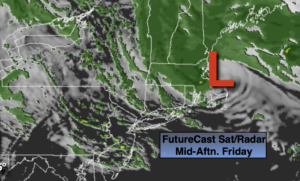
Friday:
Sun and clouds during the morning, otherwise becoming mostly cloudy with spotty showers. A steady band of rain may move into the NYC vicinity and to the North and East during the afternoon for a time. Cool. Highs in the lower 50s. Northwest winds at 10-20mph.
Tonight:
Scattered showers early, otherwise becoming partly cloudy. Lows around 40º in the City, the mid to upper 30s inland. Northwest winds at 10-20mph.
Saturday:
Partly sunny. Highs in the upper 50s.
Sunday:
Partly sunny. Seasonal. Highs around 60º.
Monday:
Partly sunny. Highs in the lower to mid 60s.
Tuesday :
Partly sunny. Warmer. Highs in the upper 60s.