Synopsis:
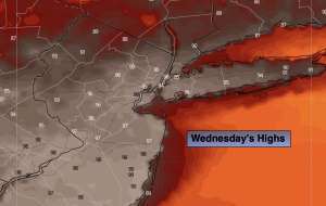
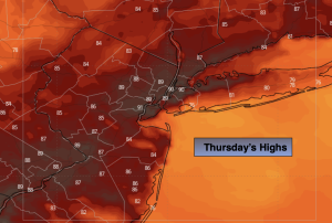
Today will be the last hot day of the week. If we reach 90º it will officially be a heat wave.
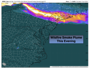
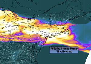
Smoke from the Canadian wildfires will obscure the sun today. Those with respiratory issues should remain indoors as much as possible.
It’ll be more comfortable Friday with a wind from the North. Hopefully, the smoke should dissipate by afternoon. Skies will be partly sunny.
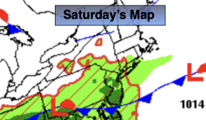
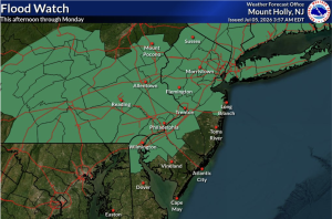
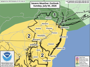
On Saturday weak low pressure will be to our South. This system will be responsible for scattered showers and storms.
Sunday will be the better half of the weekend. Partly sunny skies and seasonal temperatures are expected.
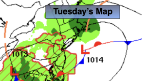
The week will start off bright and warm as high pressure moves overhead.
Stay tuned.
Keep it here for a no nonsense, no hype forecast…
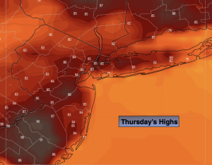
Thursday:
Mostly cloudy. Hot. Areas of smoke. Highs around 90º. West to Northwest winds at 10-20mph.
Tonight:
Mostly cloudy. Areas of smoke. Lows in the lower 70s in the City, the 50s & 60s inland. Northwest winds at 5mph.
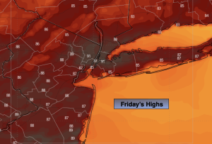
Friday:
Mostly sunny. Areas of smoke in the morning. Highs in the mid 80s.
Saturday:
Mostly cloudy. Humid. Chance of showers and storms. Highs in the lower 80s.
Sunday:
Partly sunny. Highs in the mid 80s.
Monday:
Sunny. Highs in the mid 80s.