Synopsis:
Scattered showers will continue tonight as the system that has provided grey, damp skies is on it’s last hoorah.
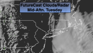
On Tuesday and Wednesday a weak ridge of high pressure will influence our area. A mix of sun and clouds is expected with near seasonal readings Tuesday and mild readings for Wednesday. It will feel good!
A developing storm will affect the region for late week. Rain is in the forecast for Thursday. The storm will slowly pull away on Friday. Showers will taper off during the day. This storm has an energetic upper level cold low. This will result in very chilly temperatures both Thursday and Friday.
The sun will return for the beginning of the weekend with near average temperatures.
Stay tuned.
Keep it here for a no nonsense, no hype forecast.
Tonight:
Occasional showers. Lows in the lower 40s in the City, the upper 30s inland. Northeast to North wind at 8-12mph.
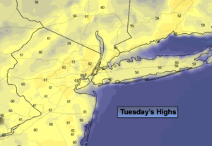
Tuesday:
Partly sunny. Seasonal. Highs around 60º. North wind at 5-10mph.
Wednesday:
Partly sunny. Highs in the mid 60s.
Thursday:
Rain likely. Chilly. Highs in the upper 40s.
Friday:
Morning showers, remaining mostly cloudy. Chilly. Highs around 50º.
Saturday:
Partly sunny. Highs around 60º.