Synopsis:
Happy Hanukkah!
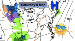
Tranquil conditions are expected for the beginning and mid portion of the up coming week as high pressure moves in. The sun will dominate and readings will be just below average. Winter arrives on Wednesday at 4:48PM.
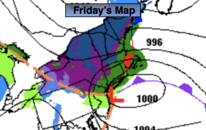
The well advertised storm for late week in the Eastern one half of the country will develop on Thursday over the Southern Plains. The track will be well West of our region and in to Western NY state by late Friday. This is a warm solution and will be a rain event. At the onset, the precipitation on Thursday afternoon may start as mix North and West but it will be short-lived as the mix will quickly change over to rain.
This will be a monster of a storm. Blizzard conditions and very strong winds are expected. Again, we are on the warm side. Rain will become heavy at times Thursday night into Friday morning. Winds will increase and become quite strong. It’ll be balmy Friday with most readings soaring into the 50s. Rain is expected Friday. The bomb storm will swing a significant cold front our way later in the day or evening with rapidly falling temperatures.
Stay tuned.
Keep it here for a no hype, no nonsense forecast.
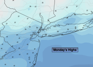
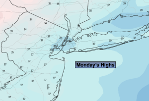
Monday:
Mostly sunny. Highs in the mid to upper 30s. West winds at 10-20mph.
Tonight:
Party cloudy. Lows in the upper 20s to around 30ºalong the urban corridor, the teens and 20s inland. West winds at 8-12mph.
Tuesday:
Sunny. Highs in the lower 40s.
Wednesday:
Sunny. Highs around 40º.
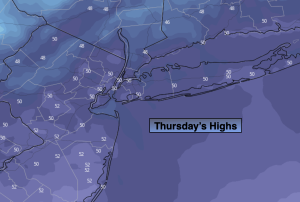
Thursday:
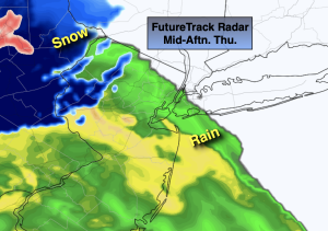
Thickening clouds. Rain most likely developing during the afternoon. A mix possible for a time well inland. Becoming Breezy. Highs in the 30s well inland the 40s at the coast.
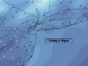
Friday:
Areas of rain, heaviest in the morning. Windy. Highs in the 50s to around 60º South. Tumbling temperatures later in the day.