Synopsis:
Today will start off with sun, but clouds will move in during the day. Spotty showers are possible by afternoon as an impulse from the West moves through. It’ll be very mild.
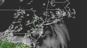
Scattered showers are in the forecast for tonight with moisture moving up from the South.
A developing storm off the Delmarva coast will affect the region Thursday with rain and chilly readings. It will be raw. The storm will slowly pull away on Friday into Eastern New England. Spotty showers are possible just about anytime but it won’t be a washout. This storm has an energetic upper level cold low. This will result in another chilly day on Friday.
The sun will return for the weekend with near average temperatures as high pressure influences the region.
Stay tuned.
Keep it here for a no nonsense, no hype forecast.
Today:
Sun and clouds. Spotty PM showers. Mild. Highs in the mid to upper 60s. Northwest to Southeast winds 5-10mph.
Tonight:
Scattered showers. Lows in the 40s throughout. Southeast to East winds at less than 5mph.
Thursday:
Rain likely. Chilly. Highs in the upper 40s.
Friday:
Spotty showers, remaining mostly cloudy. Cool. Highs in the lower 50s.
Saturday:
Partly sunny. Highs around 60º.
Sunday:
Partly sunny. Highs around 60º.