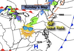
Synopsis:
Any clouds, isolated early morning flakes or showers will give way to sunny sunny skies. Readings will still be above average by about five degrees (the average high is in the upper 30s.)
Tonight will be clear and still not as cold as it should be for January.
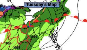
High pressure will move in from the West on Tuesday and Wednesday bringing with it abundant sunshine and still above average readings.
More clouds are expected for Thursday as a maritime flow develops.
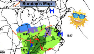
Rain is likely Thursday night and Friday as a low develops over the Ohio Valley and moves well to our West into Upstate New York. This like all of the other storms is a warm track, hence the rain and not snow. Our La Niña Winter continues.
Stay tuned.
Keep it here for a no hype, no nonsense forecast.
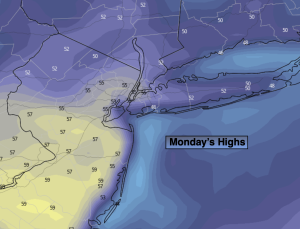
Monday:
A few early morning flakes or showers, otherwise clouds giving way to sun. Highs in the lower to mid 40s. Northwest winds at 8-12mph.
Tonight:
Clear. Lows in the mid 30s in the City, the 20s inland. West Northwest winds at 8-12mph.
Tuesday:
Sunny. Highs in the mid 40s.
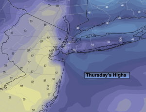
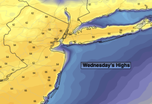
Wednesday:
Sun to clouds. Highs in the lower to mid 40s.
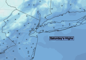
Thursday:
Mostly cloudy. Highs in the lower to mid 40s.
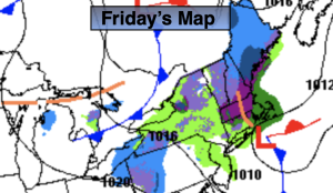
Friday:
Rain likely, mainly in the morning. Mild. Highs around 50º.