Synopsis
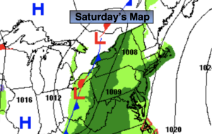
Scattered showers and mild temperatures will be the story for the last day of 2022. Areas of fog will add to the gloom, especially in the morning. Low pressure will move out of the Southern Appalachians. The showers will become more widespread toward evening. It’s a mild storm track. At the stroke of midnight there will be areas of rain and it’ll be very mild with readings around 50º!
The storm will move out of the region for New Year’s Day but the mild temperatures will stick around for the beginning of 2023 as all the cold air is locked up in Canada. It’ll be a mainly sunny for Monday, January 2nd.
Low pressure will move out of the Ohio Valley and toward the region later Tuesday and into Wednesday. Clouds and sun and a few showers later in the day are in the forecast for Tuesday. Periods of rain and balmy conditions are expected for Wednesday.
Temperatures through the the next five days will be ten to twenty degrees above the average high of around 40º.
Stay tuned.
Keep it here for a no hype, no nonsense forecast.
New Year’s Eve:
Cloudy with scattered showers and areas of morning fog. Mild. Highs in the mid 50s. East to Southeast winds at 5mph.
Tonight:
Areas of rain. Mild. Lows in the upper 40s along the urban corridor to the upper 30s and 40s inland. Winds becoming West at 5-10mph.
New Year’s Day:
Mostly sunny. Still mild. Highs in the mid 50s.
Monday:
Sunny. Highs around 50º.
Tuesday:
Clouds and sun. Chance of afternoon showers. Highs in the mid to upper 50s.
Wednesday:
Periods of rain. Balmy. Highs around 60º.