Synopsis:
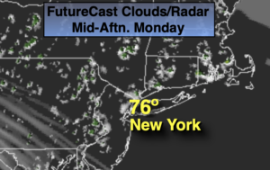
Today will be a comfortable day with readings closer to the average high of the lower to mid 70s. A mix of clouds and sun is expected as high pressure moves off the coast.
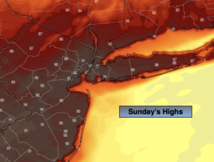
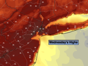
By Wednesday, readings once again will feel like a day out of July as a southwesterly flow around a Bermuda high takes hold. Spotty Storms are possible by Wednesday evening and night. Not all areas will receive the desperately needed rain.
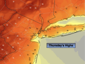
The warm weather will stick into Thursday under a mix of sun and clouds.
Cooler Readings are expected for the end of the week with a wind off the Atlantic. An area of low pressure may give us some much needed rain by Friday afternoon.
Unfortunately, many of the computer models have low pressure offshore on Saturday. This could result in the showers sticking around. I know, it’s the beginning of the Memorial Day Weekend. It’s several days away and change is always a possibility. The rest of the Holiday weekend is looking decent at this time-fingers crossed.
Stay tuned.
Keep it here for a no nonsense, no hype forecast.
Today:
More clouds than sun. Highs in the lower 70s. South to Southwest winds at 8-12mph.
Tonight:
Partly cloudy. Lows in the lower 60s in urban areas, the upper 50s inland. Southwest winds at 5mph.
Wednesday:
Partly sunny and very warm. Spotty late day storms. Highs in the mid to upper 80s.
Thursday:
Mostly sunny. Warm. Highs in the mid 80s.
Friday:
Mostly cloudy with the chance of afternoon rain. Much cooler. Highs in the upper 60s.
Saturday:
Mostly cloudy with the chance showers. Cool. Highs in the upper 60s.