Synopsis:
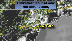
A Southerly flow will continue around a Western Atlantic high through Wednesday. The heat has peaked and readings won’t be as oppressive as the last couple of days. Unfortunately, we can’t say the same about the humidity. It will be sticky. A mix of sun and clouds is expected with afternoon and evening scattered showers and storms. Some of the rain maybe torrential at times.
A cold front will pass through the region on Thursday with relief from the heat and humidity. Scattered showers are possible, otherwise a mix of sun and clouds is expected.
On Friday, the front to our South may make a run for our area and nudge north. If this occurs more clouds and showers are possible. It will be much cooler with readings actually well below the average high of 77º. It may remain in the upper 60s.
Saturday will be bright and comfortable as high pressure works in.
Stay tuned.
Keep it here for a no nonsense, no hype forecast.
Today:
Hazy, very warm and humid. Scattered PM Storms. Highs in the mid 80s to around 90º. Cooler at the coast. South winds at 5-10mph.
Tonight:
Evening scattered storms, otherwise partly cloudy. Lows in the lower 70s in the City. Lows in the upper 60s inland. Calm winds.
Wednesday:
Hazy, very warm and humid. Scattered PM Storms. Highs in the upper 80s to around 90º. Cooler at the coast.
Thursday:
Sun and clouds .Cooler. Scattered showers possible. Highs around 80º.
Friday:
Sun and clouds. Very cool. Scattered showers possible. Highs only in the upper 60s to around 70º.
Saturday:
Mainly sunny. Comfortable. Highs in the mid 70s.