Synopsis:
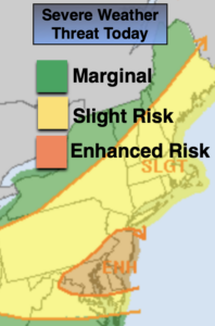
Today will feature a mix of sun and clouds. It won’t be as hot or humid as yesterday. A weak boundary will be draped over the region. This will spark an isolated storm later in the day, especially West. Much of the region will be storm-free.
Scattered showers and storms are expected overnight with the weather system remaining over the region.
Saturday is the greatest threat for showers and storms as a cool front approaches and the remnants of tropical system Laura move through. Local downpours are possible and some of the storms maybe strong.
Sunday will be the better half of the weekend with a refreshing Northwest wind and mostly sunny skies.
High pressure will move in for the beginning of next week. It will be pleasant as we turn the calendar page to September on Tuesday.
Stay Tuned.
Keep it here for a no nonsense, no hype forecast.
Today:
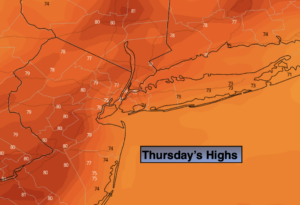
A mix of sun and clouds. Not as hot or humid. Late day scattered storms are possible, especially West. Highs in the mid 80s. Northwest to West winds at 5-10mph.
Tonight:
Scattered showers and storms. Muggy. Lows in the lower 70s in the City, the upper 60s inland. West to Southwest winds less than 5mph.
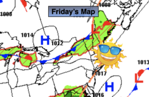
Saturday:
Hazy and humid. On and off showers and storms with local downpours. Highs around 80º.
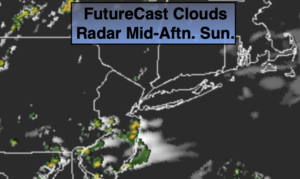
Sunday:
Mostly sunny and less humid. Highs around 80º.
Monday:
Sunny. Low humidity. Highs in the upper 70s.
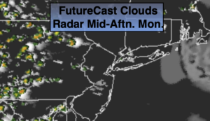
Tuesday:
Sun and clouds. Scattered late day storms. Highs around 80º.