Synopsis:
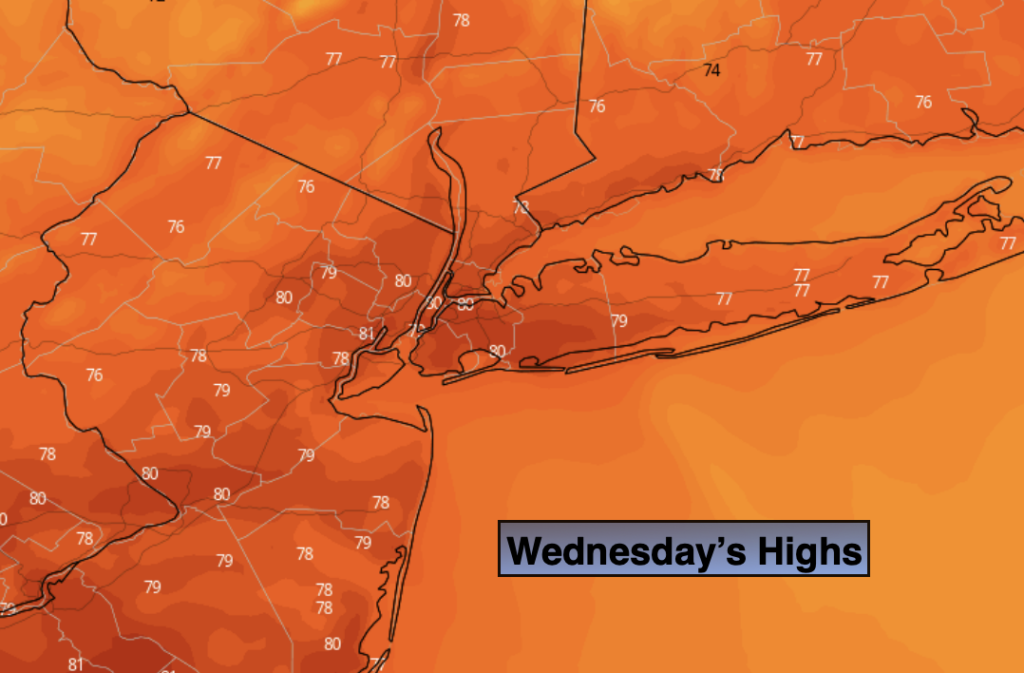
It will be much more comfortable today with a flow out of Canada. Readings will be below the average high of 83º and the humidity will be much lower under sunny skies. A fall feel for sure. But don’t get to used to it as warmer and more humid conditions will be back tomorrow.
A warm front will approach tonight. Scattered showers and storms are possible late. Any morning scattered storms will move offshore and hazy sun will develop Thursday. A push of hot and humid air will rapidly move in. Readings will flirt with 90º. A disturbance will move into the region later in the day and evening with another round of scattered storms. Some of these storms maybe turn severe.
Friday will be warm and humid under a mix of sun and clouds. A weak boundary will be draped over the region. This will spark an isolated storm later in the day.
Saturday is the greatest threat for showers and storms as a cool front approaches and the remnants of tropical system Laura move through.
Sunday will be the better half of the weekend with a refreshing Northwest wind and mostly sunny skies.
Stay Tuned.
Keep it here for a no nonsense, no hype forecast.
Today:
Sunny with very low humidity. Highs in the upper 70s. Northwest winds at 10-15mph.
Tonight:
Mostly cloudy with scattered showers and storms late. Lows around 70º in the City, the 60s inland. Northwest to West winds less than 5mph.
Thursday:
Scattered morning showers and storms. Becoming Partly sunny, hot and more humid. Scattered late afternoon and evening storms are possible. Highs around 90º.
Friday:
Hazy, warm and humid. Afternoon scattered storms are possible. Highs in the mid 80s.
Saturday:
Hazy and humid. Showers and thunderstorms are likely. Highs in the lower 80s.
Sunday:
Mostly sunny. Cooler and less humid. Highs around 80º.