Synopsis:
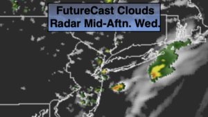
Today’s weather map will feature a disturbance moving through with the jet stream. What this will result in is a mix of clouds and sun with the chance of spotty showers and an isolated storm just about anytime. The majority of the day will be dry. It’ll be comfortable with readings a couple degrees below the average high of 83º.
It’ll be mostly clear and cool tonight. The AC will once again take a a break.
High pressure will move over the region for the late week period and into the weekend. Mainly sunny skies are expected with moderating temperatures. The humidity will be in check through Friday but begin to creep up through the weekend. Several nice August days are on the way.
Stay Tuned.
Keep it here for a no nonsense, no hype forecast.
Today:
Sun and clouds. Isolated showers and possibly a thunderstorm. Most of the day will be dry. Highs around 80º. Northeast winds at 5mph.
Tonight:
Mostly clear. Cool. Lows in the mid 60s, the 50s inland. North winds at 5mph.
Thursday:
Sunny. Highs around 80º.
Friday:
Mostly sunny. Highs in the mid 80s.
Saturday:
Hazy, warm and humid. Highs in the mid to upper 80s.
Sunday:
Hazy, warm and humid. Isolated afternoon storms. Highs in the mid to upper 80s.