Synopsis:
There will not be a dominant weather system affecting our area the next several days. What this means is that there will be times of clouds and chances of showers through midweek next week. There will be nicer days than others and the hot weather is on hiatus for some time.
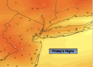
A mix of clouds and some sun is expected for today. It will be much cooler with readings actually below the average high of 77º. A weak disturbance with result in scattered showers over areas. This will occur primarily to the South and West of the City.
The weekend looks fairly decent with Saturday being the better of the two days. There’s a chance of scattered showers on Sunday. It will not be a washout. Both days will have temperatures just below the average highs.
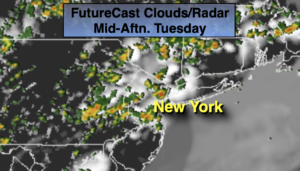
Warmer weather will greet us for the beginning of the week. A mix of sun and clouds is expected with another chance of showers on Tuesday as the last in weak disturbances moves through.
Stay tuned.
Keep it here for a no nonsense, no hype forecast.
Today:
Clouds and sun. Much cooler. Scattered showers possible mainly South and West of the City. Highs in the lower 70s. East winds at 8-12mph.
Tonight:
Mostly cloudy. Lows around 60º in the City. The 50s inland. East winds at 5mph.
Saturday:
Sun and clouds. Highs in the lower to mid 70s.
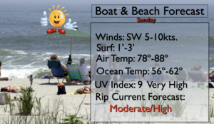
Sunday:
Clouds and sun. Scattered showers are possible. Highs in the mid 70s.
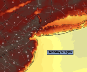
Monday:
Partly sunny. Warmer. Highs around 80º.
Tuesday:
Partly sunny. Scattered showers. Highs around 80º.