Synopsis:
Today will be steamy under hazy sunshine for this first full day of Summer. The humidity will peak as a tropical connection sets up from the Bahamas. A cool front will approach the region this evening with scattered storms.
Relief from the heat and humidity will arrive on Tuesday. Much cooler readings are expected. Temperatures will be several degrees below the average high of the lower 80s. Humidity levels will also be much lower. The front will have moisture riding up along it. Showers are likely from time to time.
High pressure over the Ohio Valley will move off the Northeast coast through late week. This will keep the heat and humidity at bay. Some nice conditions to say the least for early Summer.
Stay tuned.
Keep it here for a no nonsense, no hype forecast.
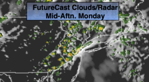
Today:
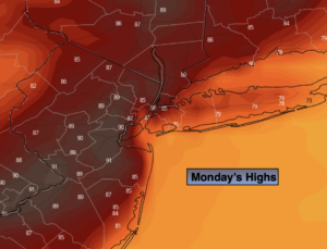
Steamy. Hazy sun. Scattered storms by evening. Highs in the upper 80s. Cooler at the coast. South winds at 8-15mph.
Tonight:
Scattered showers and storms. Lows in the 60s throughout. South winds becoming West at 5mph.
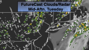
Tuesday:
Mostly cloudy with scattered showers. Much cooler and less humid. Highs in the lower to mid 70s.
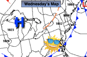
Wednesday:
Sunny. Comfortable. Highs in the mid 70s.
Thursday:
Sunny. Highs in the upper 70s.
Friday:
Partly sunny. Highs around 80º.