Synopsis:
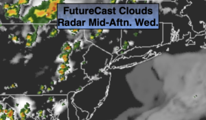
Isolated showers and storms will continue through Midnight. Many areas will remain dry. Skies will become partly cloudy overnight.
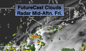
Friday will be a bit more tolerable with it not be quite as hot or humid as slightly drier air works in. The day will feature more clouds with a weak boundary draped across the region. Spotty showers or storms are possible just about anytime, but once again much of the day will be dry.
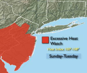
A typical July weekend is on the way. The sun will dominate as a Bermuda high re-establishes itself. This is the weather system that results in the 3 H’s along the East coast. Saturday will be hot. Sunday will be a scorcher with high heat and humidity. The heat will spill into the beginning of next week.
Stay Tuned.
Keep it here for a no nonsense, no hype forecast.
Tonight:
Evening spotty showers or storms, otherwise partly cloudy, warm and muggy. Lows in the mid 70s in urban areas, around 70º inland. West to Northwest winds at 5mph.
Friday:
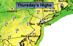
Clouds and sun. Warm, slightly less humid. Spotty showers and storms. Highs in the mid 80s. Northeast to Southeast winds at 5-10mph.
Saturday:
Mostly sunny, hot and humid. Highs around 90º.
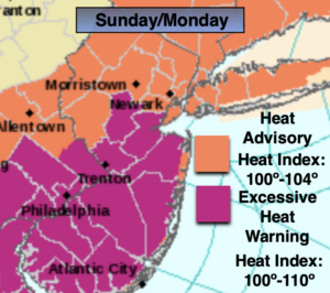
Sunday:
Hazy, hot and humid. Highs in the lower to mid 90s. Heat Index: 98º-103º.
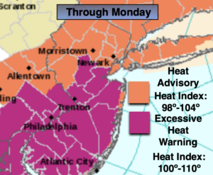
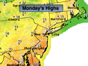
Monday:
Hazy, hot and humid. Highs in the mid 90s. Heat index: 100º-110º.
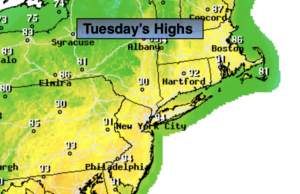
Tuesday:
Hazy, hot and humid. Scattered PM storms. Highs in the lower to mid 90s. Heat Index: 100º-105º.