Synopsis:
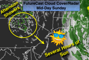
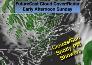
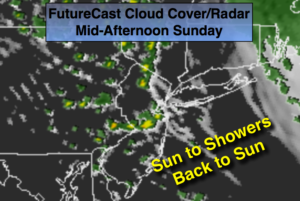
The storm that affect our weather for the first half of the weekend will continue to move off the New England coast. Mother’s Day will feature morning clouds East of the City but the clouds will give way to several hours of sun throughout. An upper level disturbance will swing in from the Northwest from mid-day into the afternoon with scattered showers. It will be a very changeable afternoon as we’ll go from sun to a moderate shower within minutes. There may even be a rumble of thunder (FutureCast Cloud Cover/Radar above). To reiterate, the day will not be a washout and the sun will shine for a time! Whew.
Much warmer times are in our future as we head into next week with readings getting well into the 80s.
Stay tuned.
Mother’s Day:
Early morning clouds East of the City, otherwise becoming partly sunny for several hours during the morning. Spotty showers will develop during the afternoon. A quickly moving thunderstorm is possible in spots. Highs in the mid 60s. Northwest winds at 10-15mph.
Tonight:
Spotty evening showers, otherwise, becoming mostly clear. Breezy. Lows in the 40s to around 50º. Northwest winds increasing to 15-25mph.
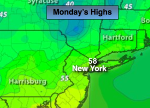
Monday:
Partly sunny. Highs in the mid 60s.
Tuesday:
Mostly sunny, milder. Highs in the mid 70s.
Wednesday:
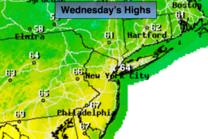
Mostly sunny, warm. Highs in the mid 80s.
Thursday:
Hazy, hot and humid. Highs in the upper 80s.
Keep it here for a no nonsense, no hype forecast.