Synopsis:
This is as good as July gets. Mostly sunny, warm conditions are expected through tomorrow. The humidity levels will be very low as high pressure moves over the region.
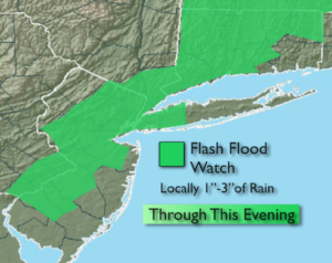
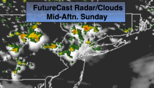
The weekend has some questions that need be answered. An area of low pressure will move up the coast from the Carolina’s later Saturday into Sunday morning. How fast and how close the low comes to our area will determine when and how much rain will fall. At this time Saturday should feature sun giving way to clouds. Some of the models have rain moving into the area; I’m not convinced of this yet. The best potential of steady and heavier rain will be Saturday night and Sunday morning. As the low pulls away Sunday some sun is expected. Scattered showers and storms are possible during the afternoon.
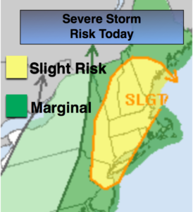
An upper level low will move into the Appalachians Sunday through the beginning of the week. At the same time, a strong high pressure system will be over the Western Atlantic. This will result in a deep Southerly flow of tropical air. Scattered showers and storms are possible. Some of the rain maybe heavy.
Stay tuned.
Today:
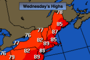
Sunny. Highs in the lower to mid 80s. Northeast to Southeast winds at 5-10mph.
Tonight:
Clear, comfortable sleeping weather. Lows in the mid to upper 60s in the City, the 50s inland. South wind less than 5mph.
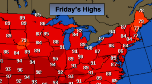
Friday:
Sunny. Highs in the mid 80s.
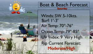
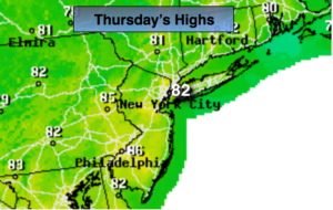
Saturday:
Sun giving way to afternoon clouds. Highs in the lower 80s.
Sunday:
Mostly cloudy with a chance of showers and storms. Highs lower 80s.
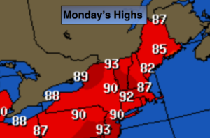
Monday:
Hazy, warm and humid with scattered storms. Highs mid 80s.
Keep it here for a no nonsense, no hype forecast.