Synopsis:
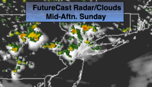
A couple of disturbances in the upper atmosphere will spark scattered showers and storms this morning and again later this afternoon. It will not be a washout. There will be hazy sun in between. It’ll very warm and humid.
Monday will feature partly sunny skies. The three H’s will be with us. An isolated afternoon storm is possible. Most areas will be rain-free.
A potent cool front will move toward the area on Tuesday with scattered thunderstorms. Some of the storms maybe severe with torrential rain. It’ll still be very warm and humid.
Relief will arrive by Wednesday as a refreshing airmass moves in from Canada.
Stay tuned.
Today:
Spotty early morning showers and storms, otherwise hazy, hot and humid. Another round of scattered storms is likely during the afternoon. Highs in the upper 80s. Southwest winds at 5-10mph.
Tonight:
Any evening scattered storm, otherwise partly cloudy. Warm and muggy. Lows in the mid 70s in the City, the upper 60s inland. Southwest wind less than 5mph.
Monday:
Hazy, hot and humid. An isolated afternoon storm is possible. Highs around 90º.
Tuesday:
Hazy, very warm and humid with scattered afternoon thunderstorms. Highs in the upper 80s.
Wednesday:
Mostly sunny, warm and much less humid. Highs in the mid to upper 80s.
Thursday:
Sunny. Highs in the mid 80s.
Keep it here for a no nonsense, no hype forecast.