Synopsis:
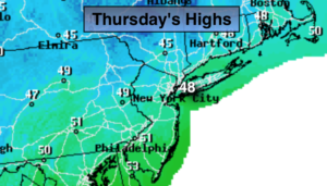
Today will be most likely the coldest day of the season so far this season with a biting wind- a Winter feel. Skies will be partly sunny. Winds will gust up to 35mph making the windchill near 40º.
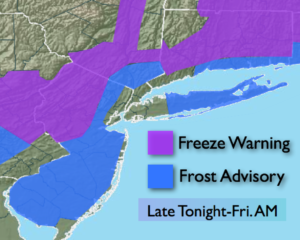
Clear skies & diminishing winds will be ideal for frost formation outside of the City tonight. Readings will be in the 30s throughout.
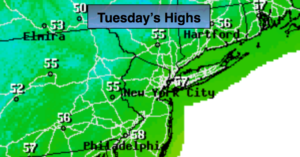
High pressure will work in for the beginning of the workweek. Temperatures will slowly recover to near seasonal levels by Tuesday, which is near 60º.
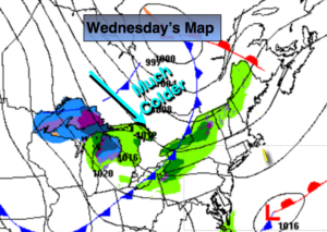
Another cold front will move through Wednesday bring our readings to below average levels once again.
There has been chatter about an East coast storm next weekend. You know my philosophy on possible events over 5 days away-it’s way to early to make a guess on where this system may form or track. The setup is there for a storm to develop.
You know where to find a no hype, no nonsense forecast.
Stay tuned.
Today:
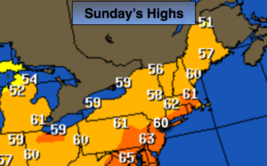
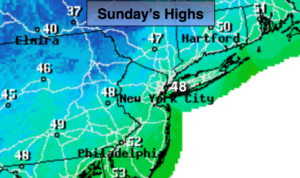
Partly sunny, windy and cold. Highs near 50º in the City falling into the 40s. Northwest winds at 15-25mph with gust to 35mph.
Tonight:
Mostly clear and cold. Lows in the 30s throughout. Northwest to West wind diminishing to 5mph..
Monday:
Mostly sunny and cool. Highs in the lower 50s.
Tuesday:
Partly sunny. Highs near 60º.
Wednesday:
Partly sunny. Highs in the mid 50s.
Thursday:
Partly sunny, colder. Highs in the upper 40s.
Keep it here for a no nonsense, no hype forecast.