Synopsis:
The Nor’easter that affected the area with gusty winds, rain and coastal flooding will move into New England tonight. Drizzle or light rain will come to an end early tonight. The winds will diminish and water will recede from coastal flooding. Skies will remain mostly cloudy overnight.
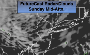
Sunday will be the better half of the weekend with a mix of sun and clouds. We’ll be between systems.
Another area of low pressure will develop on a second round of energy working in with the jet stream. A round of showers is likely Sunday night into Monday morning. More clouds than sun is expected Monday.
A tranquil period is expected midweek as high pressure moves in. Temperatures will moderate to above average levels by Halloween, great trick or treating weather! Thursday will feel like Spring with readings well into the 60s.
You know where to find a no hype, no nonsense forecast.
Stay tuned.
Tonight:
Areas of drizzle and light rain ending early tonight. Winds will diminish and it’ll remain mostly cloudy. Lows in the mid 40s in the City the upper 30s well inland. Winds becoming West at 5-10mph.
Sunday:
Clouds and sun. Highs in the mid to upper 50s. West winds at 8-12mph.
Monday:
Mostly cloudy. Chance of showers in the morning. Highs in the mid 50s.
Tuesday:
Partly sunny. Highs in the mid 50s.
Halloween:
Partly sunny and milder. Highs in the mid 60s.
Thursday:
Partly sunny. Mild. Highs in the mid to upper 60s.
Keep it here for a no nonsense, no hype forecast.