Synopsis:
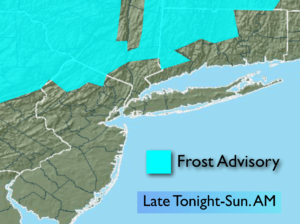
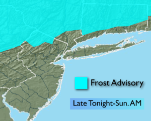
High pressure will move in tonight and Sunday. This will setup the stage for the first frost of the season North and West of the City. It would be advised to bring in potted plants; they may not make it through the night where the frost occurs.
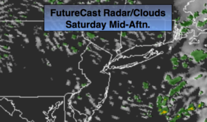
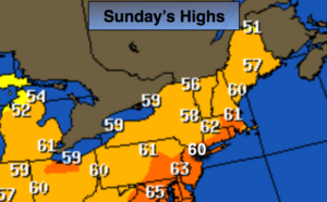
Sunday will be the better half of the weekend with abundant sunshine and cool readings with the high over the region.
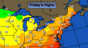
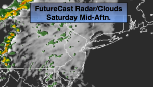
A weak front will move through the area on Monday with another round of showers; It’ll be milder.
Cool temperatures will stick around next week as the flow is coming out of the Northwest. It looks like Autumn wants to stick around.
You know where to find a no hype, no nonsense forecast.
Tonight:
Becoming mostly clear and cold. Lows in the mid 40s in the City, the 30s inland. Scattered frost is possible well inland. Northwest wind diminishing to 5mph.
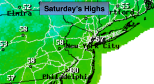
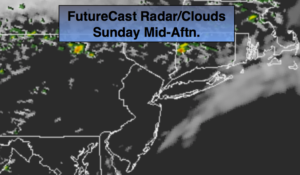
Sunday:
Mostly sunny & cool. Highs around 60º. Northwest to Southwest winds at 5-10mph.
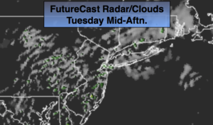
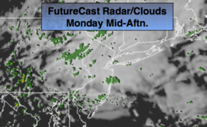
Monday:
Mostly cloudy with scattered showers. Highs in the mid 60s.
Tuesday:
Partly sunny, cooler. Highs around 60º.
Wednesday:
Partly sunny, cool. Highs around 60º.
Thursday:
Partly sunny, much cooler. Highs in the lower 50s.
Keep it here for a no nonsense, no hype forecast.