Synopsis:
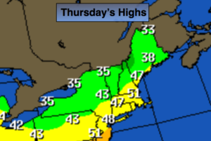
We will have gone from Winter to Spring to Summer this past week. Welcome to the crazy season of Spring in the Northeast.
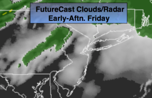
An area of high pressure will move off the Southeast coast the next 48 hours. A Southwest wind will bring temperatures up to levels that will make most happy today into Saturday. In fact, some areas may approach 80º today. A welcome change for many. It will be much cooler at the coast and parts of Long Island. It will be mainly dry through the beginning of the weekend.
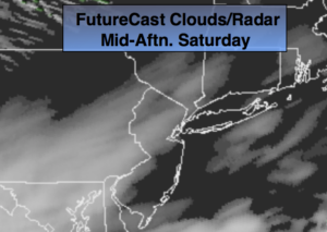
A backdoor cold front will be moving Southwest through the region on Saturday afternoon. The big question is how far Southwest does the front get? There will be a dramatic temperature difference for the tri-state area. It will be June-like on the warm side of the front and much cooler to the Northeast of the front. No matter how you slice it Saturday will still be a warm day for many areas. To the North and East of the City readings will most likely be much cooler.
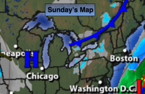
The second half of the weekend will feature a wind off the colder Atlantic. This will result in a much cooler day and will be a shock to many after Saturday’s very warm readings. Scattered showers or areas of drizzle are likely on Sunday.
A significant rain is possible on Monday as a deep Southern flow ahead of a cold front works in.
Stay tuned.
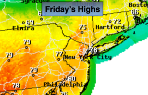
Today:
Partly sunny. Much warmer. Highs in the mid to upper 70s to around 80º. Much cooler at the coast. Southwest winds at 10-20mph.
Tonight:
Partly cloudy. Very mild. Lows in the lower 60s in the City, the 50s inland. Southwest winds at 10-15mph.
Saturday:
Partly sunny. Highs in the 70s to around 80º over inland NJ to the 50s and 60s over Northeastern areas.
Sunday:
Mostly cloudy and much cooler. Areas of drizzle and spotty showers. Highs only around 50º.
Monday:
Rain, possibly heavy at times. Highs around 60º.
Tuesday:
Mostly cloudy. Much cooler. Highs in the upper 4os.
Keep it here for a no nonsense, no hype forecast.