Synopsis:
A very active early April pattern will be with us for the next week. Rapidly changing weather conditions are expected with a roller coaster ride in temperatures.
A weak storm will move from the Great Lakes into Southeastern Canada today. A few rain or snow showers are expected in this morning. A dusting of snow is possible well North and West. Mostly cloudy for the remainder of the day. It will be breezy.
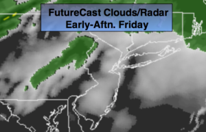
The potential for accumulating wet snow or a mix has decreased dramatically for the area on Saturday. The latest computer models have an area of low pressure and front along the East coast on Saturday. The system now looks to be just far enough offshore that the threat of accumulating wet snow has decreased. That’s not to say that a lighter wet snow or mix won’t fall. The precipitation should fall mainly to the South of the City and during the morning. Some sun is expected during the afternoon.
It definitely won’t feel like Spring though early next week. There is another chance of a bit of wet snow or a mix late Monday into Tuesday. This also looks minor at this time.
Looking down the pike a warmup may occur late next week into the following weekend.
Stay tuned.
Today:
Scattered morning snow showers and rain showers, otherwise mostly cloudy. Highs in the mid 50s. South to Southwest winds at 15-25mph.
Tonight:
Mostly cloudy with areas of light rain. Lows in the mid 30s throughout the area. West to Northwest winds at 8-12mph.
Saturday:
Chance of wet snow and or rain mainly South of the City during the morning. Late day sun. Highs in the mid 40s.
Sunday:
Mostly sunny. Highs in the lower to mid 40s.
Monday:
Mostly cloudy with scattered flurries. Highs in the mid 40s.
Tuesday:
Mostly cloudy with light wet snow or rain for a time. Highs in the mid 40s.
Keep it here for a no nonsense, no hype forecast.