Synopsis:
Even though the chill will stick around this weekend the threat of wet snow or rain is over. A front and storm developing near the Outer Banks of North Carolina tonight will track far enough to the East to spare the area of precipitation. Sunday will be cold but at least the sun will shine as high pressure moves in from the Midwest.
It definitely won’t feel like Spring though early next week. There is another chance of a bit of wet snow or rain late Tuesday. This looks like a non event.
Looking down the pike a warmup may occur late next week into the following weekend.
Stay tuned.
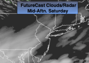
Today:
Mostly cloudy. The sun may make an appearance this afternoon. Highs in the mid to upper 40s. Northwest winds at 10-15mph.
Tonight:
Clouds will give way to clearing skies late tonight. Lows around freezing in the City, the 20s inland. North winds at 10-15mph.
Sunday:
Mostly sunny, chilly and breezy. Highs in the lower to mid 40s.
Monday:
Partly sunny. Highs in the mid 40s.
Tuesday:
Mostly cloudy with wet snow or rain showers. Highs in the mid to upper 40s.
Wednesday:
Partly sunny. Highs in the lower 50s.
Keep it here for a no nonsense, no hype forecast.