Synopsis:
Early morning rain or snow showers will taper off as a weak area of low pressure well off the coast moves away. The sun will make an appearance later today.
We are turning the page with the persistent cold. High pressure will take up residence over the Southeast this week. This will result in more seasonal temperatures Wednesday and Thursday.
As the high moves off the Southeast coast a Southwest wind should bring temperatures up to levels that will make most happy later this week and into Saturday. In fact, some areas may approach 80º by Saturday. A welcome change for many.
Stay tuned.
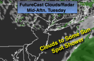
Today:
Mostly cloudy with wet snow or rain showers this morning, otherwise becoming partly cloudy. A spot shower can’t be ruled out later today. Highs in the upper 40s to around 50º. Northwest winds at 5-10mph.
Tonight:
Mostly clear and cold. Lows in the mid 30s in the City, the 20s inland. North winds at 5mph.
Wednesday:
Mostly sunny. Milder. Highs in the mid 50s.
Thursday:
Partly sunny and mild. Highs in the lower 60s.
Friday:
Partly sunny. Much warmer. Highs in the lower to mid 70s.
Saturday:
Partly sunny. June-like. Highs well into the 70s to around 80º.
Keep it here for a no nonsense, no hype forecast.