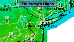
Synopsis:
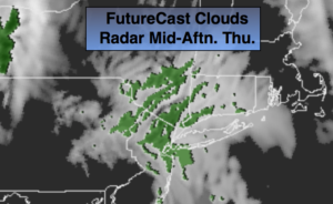
A warm from will move toward the region today bringing with it grey skies, patchy drizzle or light rain. The precipitation will be scattered, so not all areas will get wet. The wind will blow off the ocean resulting in a cool day. On Friday, the warm front will push North of the region. A deep Southerly flow will develop. Balmy conditions and scattered showers are expected. Passover begins at sundown which is at 7:39PM.
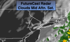
A round of steady and heavier rain is likely Friday night into Saturday. Thunderstorms are possible. Where the plume of heavy rain sets up is yet to be determined. Also, the speed of the front moving off the coast may slow resulting in the rain continuing into a part of the afternoon. Flooding is a concern, especially in areas that received heavy rain earlier this week.
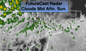
Easter Sunday will feature a mix of clouds and sun. A spot shower can’t be ruled out as an upper level low moves over the area.
Keep it here for a no nonsense, no hype forecast.
Stay tuned.
Today:
Mostly cloudy. Areas of drizzle and light rain. Highs around 60º. East to Southeast winds at 10-20mph.
Tonight:
Mostly cloudy. Mild. Lows in the 50s throughout. South wind at 10-15mph.
Friday:
Mostly cloudy and warm. On and off showers. Highs near 70º.
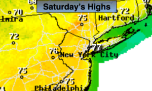
Saturday:
Rain and possible thunderstorms. The rain will taper off during the afternoon. Highs in the mid 60s.
Easter:
Clouds and sun. Spotty showers. Highs in the mid 60s.
Monday:
Partly sunny and warm. Highs in the mid 70s.