Synopsis:
High pressure will setup shop along the Southeast coast the next several days. This will result in a nice stretch with a hiccup (later this Afternoon) as a weak system moves rapidly through the region from the West.
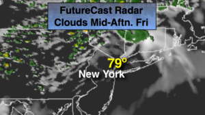
A mix of sun and clouds is expected today. A weak front will approach later in the day with spotty showers. It’ll be much warmer with readings well into the 70s to near 80º.
The weekend is shaping up to be mainly dry (finally) with a mix of sun and clouds. Saturday will be seasonal with a wind off the colder Atlantic. By Sunday, with wind will turn to the South and allow a warm bubble of air to work in. Readings will flirt with 80º. In fact, another 80º day is anticipated for Monday.
Needless to say, we have turned the corner!
Keep it here for a no nonsense, no hype forecast.
Stay tuned.
Today:
Partly sunny. Warmer. Spotty afternoon showers are possible. Highs 75º-80º. Southwest winds at 8-12mph.
Tonight:
An evening shower otherwise, partly cloudy. Lows in the upper 50s in the City, near 50º inland. Northwest winds at 5-10mph.
Saturday:
Partly sunny. Seasonal. Highs in the lower 70s.
Sunday:
Partly sunny. Slight chance of a late day shower. Much warmer. Highs near 80º.
Monday:
Partly sunny. Highs in the lower 80s.
Tuesday:
Mostly sunny. Highs in the lower 70s.