Synopsis:
High pressure along and off the East coast will be responsible for a delightful weekend. Scattered early morning showers are possible over central NJ otherwise, a mix of sun and clouds is expected. Temperatures will be warm reaching the lower 80s inland. At the coast and over Long Island readings will be much cooler due to the influence of the colder Atlantic. A distance from the West will cause scattered showers and storms later today and tonight. The thinking here is after 5pm. First areas to deal with the storms will be over Western sections. Then the activity will spread toward the coast. Some of the storms inland may approach severe limits.
Scattered showers and storms will diminish after midnight. It’ll be warm and more humid overnight.
Monday will be very warm due to a Southwest flow. Readings will get into the 80s under a mix of sun and clouds. Spotty showers and storms are possible during the afternoon and evening. The passage of a cool front will bring the temperatures down to seasonal levels (lower 70s) Tuesday and Wednesday under mainly sunny skies.
Keep it here for a no nonsense, no hype forecast.
Stay tuned.
Today:
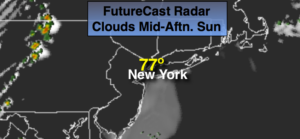
Early morning scattered showers over parts of central NJ, otherwise partly sunny and warm. Highs in the 70s to around 80º. Much cooler at the coast. Scattered showers and storms developing after 5pm today. South wind at 8-15mph.
Tonight:
Scattered showers and storms. A few of the storms maybe severe inland. Becoming partly cloudy after midnight. Warm and more humid. Lows in the 60s. South to Southwest winds at 5-10mph.
Monday:
Hazy and warm. Spotty afternoon showers or storms. Highs in the lower to mid 80s.
Tuesday:
Mostly sunny. More seasonal. Highs in the lower 70s.
Wednesday:
Sunny. Highs in the lower 70s.
Thursday:
Patly sunny. Highs in the mid 70s.