Synopsis:
Today will be very warm due to a Southwest flow ahead of an approaching cool front. Readings will get well into the 80s under a mix of sun and clouds. Spotty showers and storms are possible during the afternoon and evening. The passage of the front will bring the temperatures down to seasonal levels (lower 70s) Tuesday and Wednesday under mainly sunny skies.
The end of the week looks fairly decent with just above average temperatures.
Keep it here for a no nonsense, no hype forecast.
Stay tuned.
Today:
Hazy and warm. Spotty afternoon showers or storms. Highs in the mid 80s to near 90º over urban NJ. Cooler at the coast. Southwest winds at 10-20mph.
Tonight:
Scattered evening storms, otherwise, becoming partly cloudy and cooler. Lows in the 50s throughout. Northwest winds at 10-15mph.
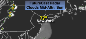
Tuesday:
Mostly sunny. More seasonal. Highs in the lower 70s.
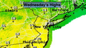
Wednesday:
Sunny. Highs in the lower 70s.
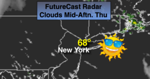
Thursday:
Partly sunny. Slight chance of late showers. Highs in the mid 70s.
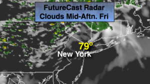
Friday:
Partly sunny. Highs in the mid 70s.