Synopsis:
High pressure over Southeastern Canada will work into the area through the weekend. This will be three days to remember. Skies will be mostly sunny with comfortably warm readings and low humidity.
By Monday, the high will slip off the coast allowing for a Southerly flow. The humidity will increase and showers are likely. The shower threat will continue into Tuesday morning.
Keep it here for a no nonsense, no hype forecast.
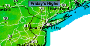
Today:
Mostly sunny. Much less humid. Highs around 80º. Northeast winds at 5-10mph.
Tonight:
Clear and comfortable . Lows in the mid 60s in the City, the mid 50s inland. Light winds.
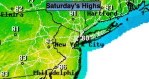
Saturday:
Sunny. Highs around 80º.
Sunday:
Mostly sunny. Highs in the upper 70s.
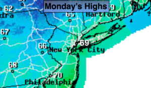
Monday:
Mostly cloudy, more humid. Scattered showers are likely. Highs in the mid 70s.
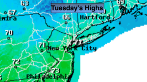
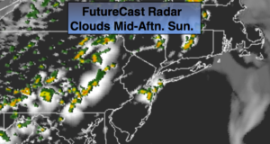
Tuesday:
Morning showers. Afternoon sun. Highs in the upper 70s.

 s
s Today: