Synopsis:.
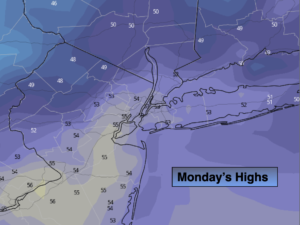
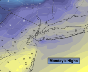
Veterans Day will be tranquil as high pressure remains offshore. Readings will be close to seasonal averages (the mid & upper 50s) under a mix of sun and clouds.
Tonight will be mostly cloudy and mild with readings in mainly in the 40s.
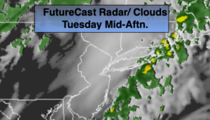
A significant cold front will approach the region on Tuesday. Morning showers have a decent chance of changing to snow showers as cold air comes rushing in during the mid to late morning hours. At this point this doesn’t look like a major concern with the white stuff. There is the potential for a dusting or coating of snow in spots. The sun will return during the afternoon. Temperatures will drop from morning highs in the 40s into the 30s and winds will increase.
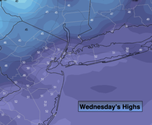
The coldest airmass of the season will be will be upon us Tuesday night and Wednesday. Readings will only be near freezing for daytime highs.
The weather looks to cooperate for the end of the week as high pressure dominates the Mid-Atlantic. Readings will recover slowly to near 50º by Friday. At least the sun will be shining.
Stay Tuned.
Keep it here for a no hype, no nonsense forecast.
Veterans Day:
Mostly sunny and mild. Highs in the upper 50s to lower 60s. Southeast winds at 5mph.
Tonight:
Mostly cloudy. Mild. Lows mainly in the 40s. Southwest winds at 5-10mph.
Tuesday:
Morning showers mostly likely changing to snow showers. Becoming mostly sunny and breezy by early to mid afternoon. Early morning highs in the 40s. Temperatures will tumble into the 30s by mid to late morning and stay in the 30s throughout the day.
Wednesday:
Mostly sunny, breezy and cold. Highs only in the lower to mid 30s.
Thursday:
Mostly sunny. Chilly. Highs around 40º.
Friday:
Mostly sunny. Highs around 50º.