Synopsis:.
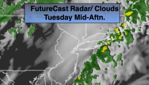
There will be more clouds than sun today as a weak disturbance rides up the coast. Spotty coastal showers are likely, mainly this morning. Readings will be near or above the seasonal averages of the upper 50s.
A cool front will move through tonight. This will set up the stage for a sunny and cooler Wednesday as high pressure moves in.
On Thursday sun will give way to clouds. A cold front will head our way. A ripple of low pressure will develop along the front. At this time there is a low potential for some rain and a mix of rain and or wet snow inland Thursday night. The storm looks to get its act together just a little to late for this to be a big deal inland. One thing looks for sure; it’ll get much colder later Friday into next weekend.
Stay Tuned.
Keep it here for a no nonsense, no hype forecast.
Today:
Mostly cloudy. Spotty coastal showers. Milder. Highs in the upper 50s to lower 60s. S0uthwest to West winds at 5-10mph.
Tonight:
Clearing skies. Lows in the lower to mid 40s in the City, the 30s inland. Northwest winds at 8-12mph.
Wednesday:
Sunny. Cooler. Highs in the lower 50s.
Thursday:
Sun to clouds. Highs in the mid 50s. A potential for light rain and a mix of rain/wet snow inland at night (not a big deal).
Friday:
Mostly sunny, windy and cold. Highs in the lower 40s.
Saturday:
Sunny and cold. Highs in the lower 40s.