Synopsis:.
New Year’s Eve day will be mostly cloudy and mild as weak high pressure moves in. At the stroke of midnight it will be tranquil with readings in the 30s.
As we welcome in 2020 on Wednesday ,the weather pattern will not change. It’ll be bright with readings above the average high of the upper 30s.
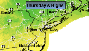
Thursday will be bright & cool.
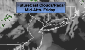
Low pressure will ride up the Eastern seaboard on Friday. Once again this will be a warm track meaning periods of rain and not snow.
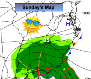
Saturday looks unsettled with a frontal system over the region. Scattered showers are possible at this time. The day could very well end up dry if the front pushes offshore enough.
The wait continues for prolonged cold and snow. The Pacific jet stream is dominating and until this pattern breaks down above average temperatures and snowless days will continue.
Stay Tuned.
Keep it here for a no hype, no nonsense forecast.
New Year’s Eve:
Mostly cloudy and mild. Highs in the upper 40s. West winds at 8-15mph.
Tonight:
Becoming partly cloudy. Lows in the mid 30s in the City, the upper 20s and lower 30s North and West. West winds at 8-15mph.
New Year’s Day:
Partly sunny. Highs in the mid 40s.
Thursday:
Mostly sunny. Highs in the lower 40s.
Friday:
Periods of rain. Mild. Highs in the lower 50s.
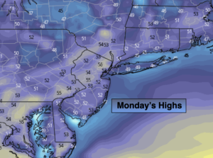
Saturday:
Scattered showers possible. Mild. Highs in the lower to mid 50s.