Synopsis:
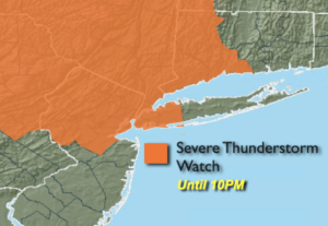
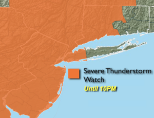
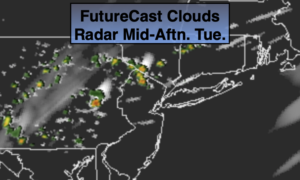
Today will be the most uncomfortable day of this current heat wave. High temperatures and high levels of humidity will make it feel around 100º or higher. A Heat Advisory is in effect for much of the tri-state area. A cool front will move into the region later today and tonight. Spotty showers and storms are possible. Some of the storms maybe strong to possibly severe. Keep an eye to the sky for threatening weather.
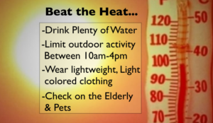
Please drink plenty of fluid. Avoid the direct sun if possible and check on the elderly and pets. Listen to your body. If you feel weak take a break.
Wednesday and Thursday will feature relief from the oppressive conditions. The sun will dominate as the heat bubble moves into the Atlantic.
The wind will veer to the South on Friday into Saturday which will bring up the humidity once again. Hazy skies are expected. It should be dry as weather systems are weak.
Stay Tuned.
Keep it here for a no nonsense, no hype forecast.
Today:
Hazy, hot and humid. Spotty PM storms. Highs in the mid 90s. Heat index: 98º-104º. West winds at 5-10mph.
Tonight:
An evening storm, otherwise mostly clear, warm and becoming less humid. Lows in the mid 70s in urban areas, the 60s inland. Light Northwest winds.
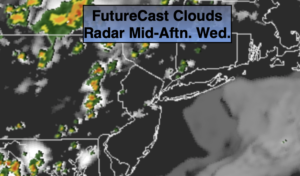
Wednesday:
Mostly sunny, not as hot or humid. Highs in the upper 80s to around 90º.
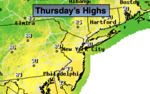
Thursday:
Mostly sunny. Very warm. Highs in the upper 80s.
Friday:
Partly sunny. Highs in the mid to upper 80s.
Saturday:
Partly sunny. More humid. Highs in the mid to upper 80s.