Synopsis:
There’ll be areas of fog and patchy drizzle during the nighttime and morning hours through Saturday as offshore high pressure brings in low level moisture. It will be warm but mainly grey. The sun may make an appearance during the afternoon hours. It will be Spring-like with readings well above the average high of the lower 60s.
The weekend looks decent with Saturday being the warmer of the two days. Sunday will be much cooler. The sun will dominate by Sunday-finally!
The clouds will once again run the show early next week as cool front approaches. Monday should be mainly dry. Scattered showers are possible Tuesday as the system approaches.
Stay Tuned.
Keep it here for a no nonsense, no hype forecast.
Today:
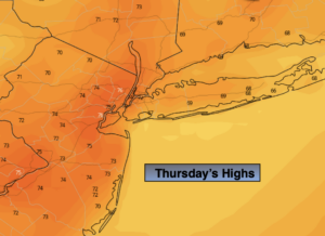
Cloudy with areas of morning fog and patchy drizzle through midday. The sun may make an appearance this afternoon for a time. Highs in the upper 60s. East to Southeast winds at 5-10mph.
Tonight:
Cloudy with areas of fog and patchy drizzle. Lows in the lower 60s in the City, the 50s inland. South winds at less than 5mph.
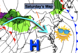
Saturday:
Morning clouds to some afternoon sun. Mild. Highs in near 70º.
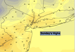
Sunday:
Mostly sunny. Much cooler. Highs in the mid 50s.
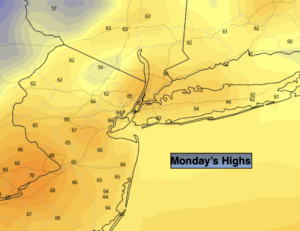
Monday:
Clouds and sun. Highs in the mid 60s.
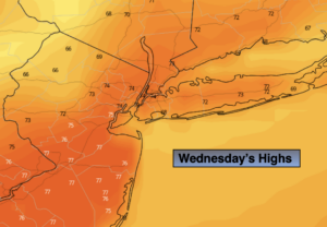
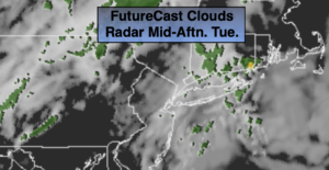
Tuesday:
Clouds and sun. Scattered showers possible. Highs in the lower 60s..