Synopsis:
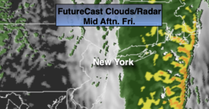
Rain will continue into the night as low pressure to our West moves into Upstate NY. A bit of sleet and or freezing rain will occur well inland early tonight. Readings will rise overnight. All areas will be above freezing after midnight.
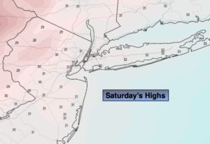
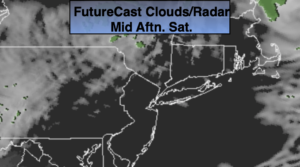
Saturday will feature clouds giving way to sun. It’ll be mild with as the flow is a Pacific one with no Canadian intrusions.
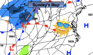
Another low pressure system will develop along the coast on Sunday. A period of rain, sleet and wet snow is likely. The best chance of frozen precipitation will be North and West. Any snow that potentially may accumulate, will occur over the higher elevations. This continues to look like a minor snowfall for inland areas.
The beginning of the work and school week looks tranquil as low pressure moves to the Canadian Maritimes and high pressure settles in over the central part of the nation. Readings will be just above average under a mix of sun and clouds. The wind will be busy Tuesday and Wednesday, but readings will be several degrees above the average high of 39º.
Stay Tuned.
Keep it here for a no nonsense, no hype forecast.
Happy New Year to all of my followers! May 2021 bring you peace, happiness and a sense of normalcy.
Tonight:
Periods of rain. Early freezing rain and sleet inland. Temperatures rising into the 40s along the urban corridor, the 30s inland. Northeast winds at 5-10mph.
Saturday:
Morning clouds, otherwise becoming partly sunny. Mild. Highs in the mid 50s.
Sunday:
Cloudy with a chance of rain, a mix and wet snow (depending on location). Highs in the lower to mid 40s, 30s inland.
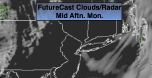
Monday:
Clouds to sun. Highs in the mid 40s.
Tuesday:
Partly sunny. Breezy. Highs in the lower to mid 40s.
Wednesday:
Partly sunny. Breezy. Highs in the lower to mid 40s.