Synopsis:
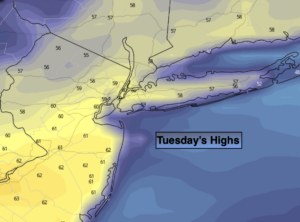
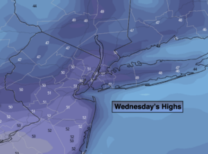
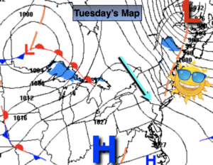
High pressure will dominate our weather through Thursday with plenty of sunshine. The high will move along and off the coast. There will be a wide range in high temperatures today. The wind will be blowing off the cold Atlantic. Temperatures by the shore and inland by ten or fifteen miles will experience much cooler readings-40’s and lower 50s. Farther inland, away from the cold ocean influence temperatures will be much milder, in the mid 50s to lower 60s. The map above tells the story; it’s all about location.
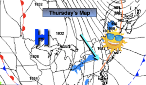
On Thursday, the wind will blow from the Southwest-a land wind. This will result in readings skyrocketing through the 60s and approaching 70º in some areas-a May feel!
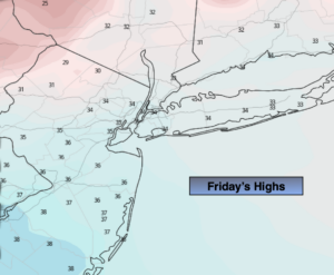
A mix of clouds and sun is expected on Friday. A weakening cool front will move through during the day. Spotty sprinkles are possible during the morning. It’ll still be warm with readings in the 60s.
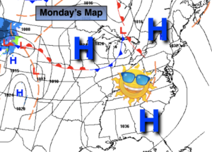
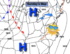
The weekend will be cooler but bright with high pressure influencing our weather from Canada.
Stay Tuned.
Keep it here for a no nonsense, no hype forecast.
Today:
Sunny. Highs in the 40s to lower 50s by the shore, the mid 50s to lower 60s farther inland. East to Southeast winds at 5-10mph.
Tonight:
Mostly clear. Lows in the mid to upper 40s along the coast, the 30s inland. Southeast winds at 5mph.
Thursday:
Mostly sunny. May-like. Highs in the mid 60s to around 70º. Cooler in spots along the coast.
Friday:
Clouds and sun. Warm. Spotty morning sprinkles. Highs in the mid 60s.
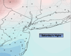
Saturday:
Partly sunny. Cooler. Highs around 50º.
Sunday:
Mostly sunny. Seasonal. Highs in the upper 40s.