Synopsis:
High pressure will move into New England New Year’s Day. This will result in a bit of Sun this January 1st morning, but clouds will increase and thicken during the day. A warm front will move toward the region introducing the chance of rain and a bit of sleet (North and West) later New Year’s Day (thinking from 3-6pm). The rain will continue into the night and into the first part of Saturday. The sun should return during the day Saturday and it will be mild.
Another low pressure system will develop along the coast on Sunday. A period of rain, sleet and wet snow is likely. The best chance of frozen precipitation will be North and West. Any snow that potentially may accumulate, will occur over the higher elevations. This continues to look like a minor snowfall for inland areas.
The beginning of the work and school week looks tranquil as low pressure moves to the Canadian Maritimes and high pressure settles in over the central part of the nation. Readings will be just above average under a mix of sun and clouds.
Stay Tuned.
Keep it here for a no nonsense, no hype forecast.
Happy New Year to all of my followers! May 2021 bring you peace, happiness and a sense of normalcy.
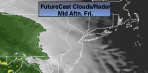
New Year’s Day:
Morning sun, otherwise thickening clouds with late afternoon rain developing. Most of the daylight hours will be dry. A mix of sleet and freezing rain is possible inland through early evening. Highs around 40º. Northeast to East winds at 5mph.
Tonight:
Periods of rain. Temperatures rising into the 40s along the urban corridor, the 30s inland. Northeast winds at 5-10mph.
Saturday:
Morning showers, otherwise becoming partly sunny. Mild. Highs in the mid 50s.
Sunday:
Cloudy with a chance of rain, a mix and wet snow (depending on location). Highs in the lower to mid 40s, 30s inland.
Monday:
Clouds to sun. Highs in the mid 40s.
Tuesday:
Partly sunny. Highs in the lower to mid 40s.