Synopsis:
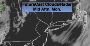
A weak disturbance will swing by this morning with spotty rain or snow showers otherwise, a mix of sun and clouds is expected. A Southwesterly flow around this system will pop the temperatures well into the 40s today.
Clear and chilly conditions are expected tonight with most readings at or below freezing.
Tuesday and Wednesday will be bright but colder as high pressure moves in from the West.
The next chance of precipitation will be about the time we ring in the new year. Late New Year’s Eve into Friday New Year’s Day a complex low with its associated fronts will move to the Eastern Seaboard. The setup is a mild one, so it looks wet and not white. The steadier rain will be on New Year’s Day.
Stay Tuned.
Keep it here for a no nonsense, no hype forecast.
Today:
A spotty morning rain or snow shower, otherwise party sunny. Milder. Highs in the mid to upper 40s. Southwest winds at 8-12mph.
Tonight:
Mostly clear. Lows near freezing in urban areas, the 20s inland. West to Northwest winds at 8-15mph.
Tuesday:
Mostly sunny. Colder. Highs in the upper 30s.
Wednesday:
Sunny. Seasonal. Highs in the upper 30s.
New Year’s Eve:
Increasing clouds. Much milder. Chance of afternoon showers. Highs in the lower to mid 50s.
New Year’s Day:
Chance of rain. Balmy. Highs in the mid 50s.