Synopsis:
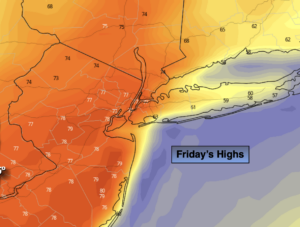
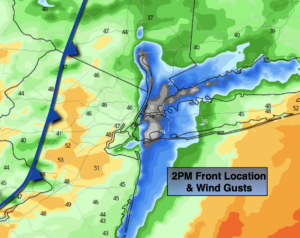
Scattered showers are likely during the morning as the warm front moves through. The sun will return and readings will pop into the mid 70s by afternoon. The reading of 75º is more typical for June 1st. Near record warmth is possible. The record is 76º set in 1922. A cool front will move through mid afternoon with a wind shift from the South to the West. Winds will gust between 40mph-50mph (2nd map above).
It’ll be windy this evening then the winds will abate overnight. It’ll still be very mild under mostly clear skies.
The better half of the weekend will be Saturday. Bright and mild conditions are expected. Low pressure develop over the area on Sunday with periods of rain.
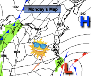
Monday and Tuesday will be dry with near seasonal readings as high pressure dominates.
Keep it here for a no nonsense, no hype forecast.
Today:
Morning scattered showers and clouds will give way to sunshine. Near record warmth is possible. Highs in the mid 70s. Cooler at the coast. Winds will increase from the South/Southwest at 15-30mph, then switch to the West and gust up to 40-50mph during the afternoon.
Tonight:
Mostly clear and windy early. Very mild. Lows in the 40 throughout. West to Northwest winds at 15-30mph with gusts to 40mph early. Winds will diminish overnight.
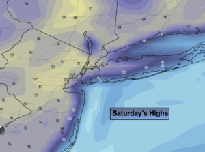
Saturday:
Mostly sunny. Mild. Highs in the mid 60s.
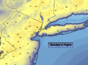
Sunday:
Periods of rain likely. Highs in the lower 60s.
Monday:
Partly sunny. Seasonal. Highs in the lower to mid 50s.
Tuesday:
Partly sunny. Highs in the mid 50s.