Synopsis:
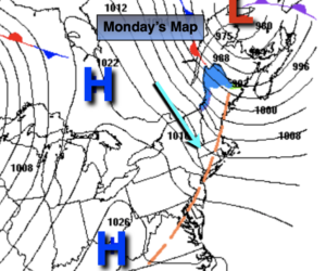
Strong winds will continue through midday. The difference in pressure between strong low pressure over Southeastern Canada and high pressure to the West is the cause of the gusty winds. Winds will diminish this afternoon as the pressure gradient relaxes. A mix of sun and clouds is expected with readings just above the average highs of the lower 50s.
Tonight will be clear and tranquil.
Tuesday will be a winner with abundant sunshine and mild readings as high pressure moves into the Atlantic.
As we turn the calendar from March to April a storm will affect the region. On Wednesday any morning sun will give way to a wet afternoon. Readings will be several degrees above the average high of the mid 50s. Rain will continue Wednesday night. April’s debut on Thursday will start off wet. The low will pull up and off the coast during the day. Morning showers will give way to afternoon sun. It will be chilly.
Friday will feature mainly sunny skies but readings will be cold for April. Highs will only be in the lower to mid 40s.
Keep it here for a no nonsense, no hype forecast.
Today:
Partly sunny, windy and seasonal. Highs in the mid 50s. West to Northwest winds at 15-30mph with gusts to 45mph early. Winds will diminish during the afternoon.
Tonight:
Clear. Lows around 40º in the City, the mid 20s to mid 30s inland. Light winds.
Tuesday:
Sunny. Much milder. Highs in the mid 60s.
Wednesday:
Thickening clouds. Afternoon rain. Highs in the lower 60s.
Thursday:
Morning showers. Afternoon sun. Highs in the upper 40s.
Friday:
Partly sunny. Chilly. Highs in the lower to mid 40s.