Synopsis:
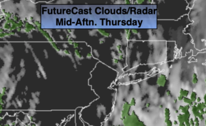
April’s debut will start off damp. The low will pull up and off the coast during the day. Colder air will filter in. On and off morning showers (there could be some wet snow well inland) will give way to afternoon sun. It will be chilly and windy.
Tonight will be cold under mainly clear skies. All readings will be at or below freezing.
Friday will feature mainly sunny skies, but despite the bright skies readings will be cold for April. Highs will only be in the mid 40s as Canadian air filters in.
Typical early April conditions are expected for Easter Weekend. The sun will dominate Saturday. A mix of sun and clouds is expected for Easter Sunday. High pressure to our South will be responsible for our decent conditions.
Monday will be bright with readings just above the average high of 56º.
Keep it here for a no nonsense, no hype forecast.
Today:
Morning on and off showers (wet snow mixed in possible well inland). Afternoon sun. Windy and turning colder. Highs in the 40s. Northwest winds increasing to 15-30mph.
Tonight:
Mostly clear and cold. Lows around freezing in the City, the 20s inland. Northwest winds at 15-30mph. Wind chills will be in the teens and 20s.
Friday:
Partly sunny. Chilly. Highs in the lower to mid 40s.
Saturday:
Mostly sunny. Seasonal. Highs in the mid 50s.
Easter Sunday:
Partly sunny. Highs in the upper 50s.
Monday:
Mostly sunny. Highs in the upper 50s.