Synopsis:
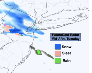
A weak impulse will move out of the central Appalachians and toward the region later today. Clouds will thicken this morning. Scattered light snow or rain showers are possible during the afternoon hours. Many areas will remain precipitation free.
The impulse will move off the coast tonight and Wednesday. Moisture from the East will result in a better chance rain and or snow showers during this time. A light coating is not out of the question inland by Wednesday morning. Much of Wednesday-St. Patrick’s Day will be grey and dry. The sun may make an appearance later in the afternoon.
A more signifiant area of low pressure will develop over the central Appalachians on Thursday. Clouds will thicken during the morning. Rain will move in during the midday hours. The latest computer guidance takes the low off the Maryland coast. With this Southern trend colder air will filter into the region on Friday. Depending on where the precipitation shield sets up any rain could mix with and possibly change to wet snow for at time. Again, this depends how far North the shield of precipitation gets. There is a low potential of some light accumulations mainly to the North of the City.
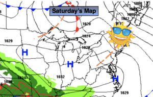
Saturday Spring arrives. The sun will shine as we turn the page to the new season. Readings will be a couple degrees off the average high of 50º.
Stay Tuned.
Keep it here for a no nonsense, no hype forecast.
Today:
Thickening clouds. Scattered light snow and rain showers during the afternoon. Highs in the upper 30s. Southeast winds at 5mph.
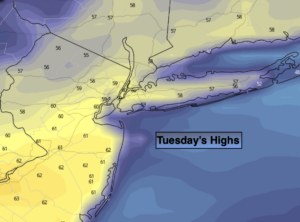
Tonight:
On and off areas of light rain. Light freezing drizzle, light snow or sleet possible inland . Lows in the mid to u upper 30s in the City, the lower 30s inland. Southeast to East winds at 5mph.
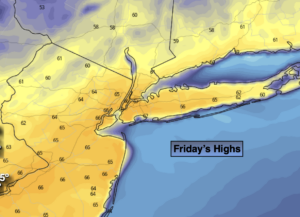
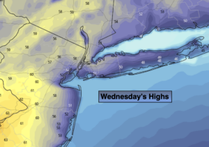
St. Patrick’s Day:
Scattered early morning showers. Remaining cloudy. Highs in the mid 40s.
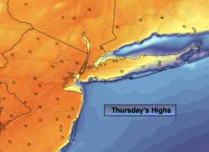
Thursday:
Thickening clouds. Rain likely by midday. Highs around 50º.
Friday:
Rain or a mix of rain and wet snow possible. Colder. Highs in the lower 40s.
Saturday:
Mostly sunny. Highs in the mid to upper 40s.