Synopsis:
Say goodbye to the brilliantly sunny days. As we all know, Spring can have big swings in conditions. It looks like we’ll be in a pattern of predominantly grey skies and cooler temperatures for several days as low pressure systems continue to affect the region. Now it won’t be raining all the time and there will be long stretches of dry times but the days of blue skies are over for a while.
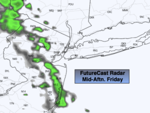
Today will start off dry under mostly cloudy skies. A few spotty showers are possible during the afternoon (most areas will remain rain-free).
Spotty showers are possible Saturday morning. The majority of the day should be dry but clouds will dominate. A wind off the colder Atlantic will keep the area cool.
More significant showers are likely on Sunday with a more vigorous low moving in. It will be milder.
The beginning of the week will feature more clouds than sun with just the chance of a shower with readings just above the average high of 60º.
Keep it here for a no nonsense, no hype forecast.
Today:
Mostly cloudy. Much cooler. Spotty showers are possible during the afternoon Highs in the upper 50s. East to Southeast winds at 5mph.
Tonight:
Scattered showers. Lows in the 40s throughout. Southeast wind less than 5mph.
Saturday:
A spot shower is possible in the morning, otherwise mostly cloudy. Highs around 60º.
Sunday:
Showers likely. Milder. Highs in the mid 60s.
Monday:
Clouds, some sun. Spotty shower. Highs around 60º.
Tuesday:
Clouds, some sun. Spotty shower. Highs in the lower 60s.