Synopsis:
A changeable pattern will be with us through the weekend. Low pressure systems will affect the region through Sunday.
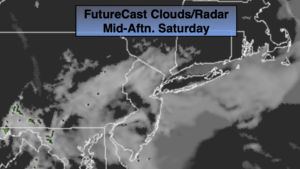
Spotty showers will move off the coast this morning as a weak impulse moves to the East. The majority of the day should be dry and some sun is possible by afternoon. Readings will be mild with the exception of areas to the North and East.
Scattered showers will move in late tonight as a warm front moves toward the region.
Rain is likely Sunday morning. There will be a break in the action during the afternoon and several hours of dry time is likely. Another round of rain and possible storms will move in Sunday evening with a cool front.
The beginning of the week will feature more clouds than sun with just the chance of a shower with readings just near the average high of 59º.
Tuesday and Wednesday will feature more sunshine with readings slightly above average with weak high pressure in control.
Keep it here for a no nonsense, no hype forecast.
Today:
A spot shower is possible in the morning, otherwise clouds giving way to some sun. Mild. Highs in the mid 60s. Cooler to the North and East. Southeast winds at 5mph.
Tonight:
Mostly cloudy with scattered showers developing late. Lows in the lower 50s in the City, the 40s inland. Southeast wind less than 5mph.
Sunday:
Rain in the morning, otherwise mostly cloudy. Rain will redevelop in the evening. Highs around 60º.
Monday:
Clouds, some sun. Spotty shower. Highs around 60º.
Tuesday:
Partly sunny. Highs in the lower to mid 60s.
Wednesday:
Partly sunny. Highs in the lower to mid 60s.