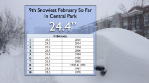
Synopsis:
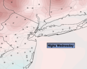
Today will feature abundant sunshine with near average readings as high pressure moves in from the West. The average high is in the mid 40s.
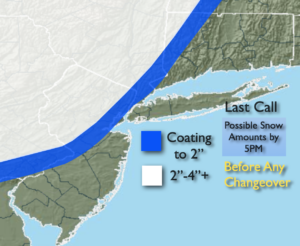
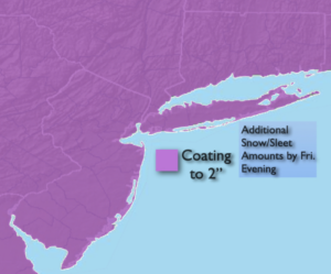
Increasing and thickening clouds tonight. Rain will develop after midnight. Well North and West a bit of snow may fall at the onset.
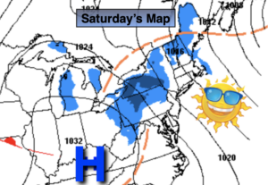
Saturday will be damp and mild. Showers are likely as a weak impulse moves our way from the South.
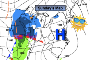
February’s finale on Sunday will be wet. Another impulse will ride along a frontal boundary to our South. This will result in mostly cloudy skies with showers likely during the afternoon.
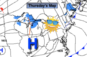
March will come in like a lamb on Monday. Under partly sunny skies readings will reach the upper 40s.
Colder sun will greet us Tuesday as a cold flow comes down from Canada.
Stay Tuned.
Keep it here for a no nonsense, no hype forecast.
Today:
Sunny. Highs in the mid 40s. Northwest to Southeast winds at 5mph.
Tonight:
Increasing clouds with rain developing after midnight. Lows in the 30s to around 40º along the coast. Southeast winds at 5mph.
Saturday:
Mostly cloudy. Scattered showers. Mild. Highs in the lower 50s.
Sunday:
Mostly cloudy. Showers likely by afternoon. Highs in the upper 40s.
Monday:
Clouds to sun. Highs in the upper 40s.
Tuesday:
Mostly sunny. Cold. Highs in the mid 30s.