Synopsis:
Skies will clear tonight as high pressure works in from the West. A refreeze of slush and standing water is expected as all temperatures will be well below freezing.
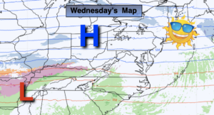
Sun will give way to clouds by late afternoon Wednesday. Many areas will crack the freezing mark.
Two weak systems will pass well to our South Wednesday night into Thursday morning and then again on Friday morning. A bit of light snow is possible mainly over Southern sections of the tri-state area. Both days will feature a mix of clouds and some sun mainly North of where the shield of light snow falls (NYC vicinity and North).
This weekend should start off tranquil. I’m keeping Saturday snow-free at this time. The models are all over the place with a potential developing coastal storm for the first half of Sunday. The threat is there for snow or a mix Saturday night into Valentine’s Day.
Needless to say, we are in a very active pattern.
Stay Tuned.
Keep it here for a no nonsense, no hype forecast.
Tonight:
Clearing skies and cold. A refreeze of slush and water will occur. There will be icy spots in untreated areas. Lows in the mid 20s in the City, the teens inland. Northwest winds at 5-10mph.
Wednesday:
Sun to clouds. Highs 30º-35º. Northwest winds at 5-10mph.
Thursday:
Morning light snow likely, mainly South of the City. Some afternoon sun. Highs around 30º.
Friday:
Potential of light snow mainly for central and Southern areas. Some afternoon sun. Cold. Highs in the mid to upper 20s.
Saturday:
Mostly cloudy. Cold. Highs around 30º.
Sunday (Valentine’s Day):
Snow potential. Late day sun possible. Highs in the upper 20s.