Synopsis:
Today will be a delight. High pressure over Southeastern Canada will provide the region with sunny skies and very low humidity although the winds will be gusty.
A fall-feel will be in the air tonight. Under clear skies readings in the distant ‘burbs may slip into the upper 40s.
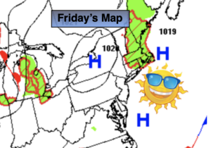
A semi-decent weekend is on the way as we say good-bye to July and hello to August. Saturday will be the better half of the weekend as High pressure moves off the Eastern seaboard. Sunny skies and low humidity is anticipated. Sunday, August’s debut, will feature a mix of sun and clouds with the threat of scattered showers and storms during the afternoon as a weak disturbance moves in from the Southwest.
The beginning of the week will be bright and warm as weak high pressure dominates.
Keep it here for a no nonsense, no hype forecast.
Today:
Mostly sunny. Breezy. Low humidity. Highs in the lower to mid 80s. Northwest winds at 15-25mph.
Tonight:
Clear and cool. Lows around 60º in urban areas, the upper 40s and 50s inland. Diminishing Northwest winds at 5-10mph.
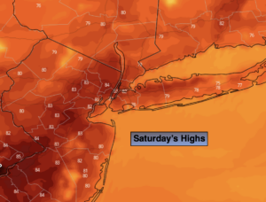
Saturday:
Sunny. Highs around 80º.
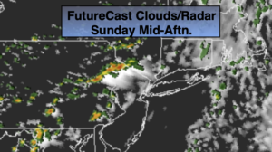
Sunday:
Sun and clouds. Scattered afternoon showers and storms. Highs in the lower 80s.
Monday:
Mostly sunny. Highs in the lower to mid 80s.
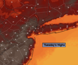
Tuesday:
Partly sunny. Highs around 80º.