Synopsis:
Strengthening high pressure will be over New England today. Morning clouds will give way to some afternoon sun as drier air works in from the North. Readings will be near seasonal averages which is around 70º.
Fine Fall conditions will be with us through the end of the week. It’ll be bright and comfortable. A couple of gems are on the way.
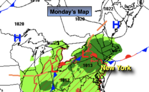
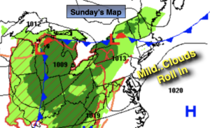
The weekend should start off decent as high pressure slips off the Northeast coast. A mix of clouds and sun is expected for Saturday. It will be the better half of the weekend. By Sunday, weak low pressure will move up and off the coast. This feature combined with the flow around the offshore high will result in a wind off the ocean. Mainly cloudy skies re anticipated with the chance of showers.
Keep it here for a no hype-no nonsense forecast.
Stay tuned.
Today:
Clouds to some sun. Highs around 70º. Northeast winds at 5mph.
Tonight:
Mostly clear. Lows around 60º in the City, the 50s inland. Light winds.
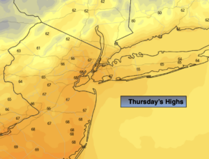
Thursday:
Sunny. Highs in the lower to mid 70s.
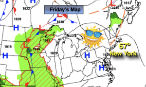
Friday:
Sunny. Highs in the mid 70s.
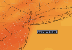
Saturday:
Partly sunny. Highs around 70º.
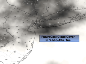
Sunday:
Mostly cloudy with scattered showers. Highs in the upper 60s.